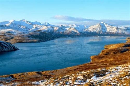
Aleutian Islands Tour Tour Details

Status: Active
Description: The Aleutian Islands are a chain of 14 large volcanic islands and 55 smaller islands. Most of the Aleutian Islands belong to the U.S. state of Alaska, but some belong to the Russian federal subject of Kamchatka Krai. They form part of the Aleutian Arc in the Northern Pacific Ocean, occupying a land area of 6,821 sq mi

The islands, with their 57 volcanoes, form the northernmost part of the Pacific Ring of Fire. The islands are considered to be among the most geographically isolated areas in the North Pacific.

These volcanic islands reach heights of 6,200 feet (1,900 m). In 1906, a new volcanic cone rose between the islets of Bogoslof and Grewingk, near Unalaska, followed by another in 1907. These cones were nearly demolished by an explosive eruption on September 1, 1907. In 2017, the volcanic cone erupted sending ash and ice particles 30,000 feet into the air.

The tour starts in Katchikan after departing your cruise ship and follows the southern coast with it's beautiful mountains inlets and bays to Anchorage. From there you'll head south to Kodiak Island and Cold Bay and then onto the Aleution islands.

From Cold Bay you'll be flying over frigid waters so a twin engine like the DHC-6 will provide safety and peace of mind. Be sure and check your fuel before each flight as there several long legs over 200 miles. Do yourself a favor and check out some of the islands you'll be flying past and take in the beauty of the snow covered volcanoes along the way. You won't be sorry you detoured.

The final destination is Attu Island and supports a Coast Guard station on the notheast tip. The ICAO is recognized differently by the major flight sims. Depending on what you fly you'll need to use the correct ICAO to complete your flight plan.

MSFS2020=PAAT

FSX/P3D==ATU

X-PLANE==PATU

This tour was created by MEC031 Tom, thank you Tom.
Aleutian Islands Tour

Return to MIRAGE Tours Page

Tour Flights

Leg Departure Arrival Flight Aircraft Distance
1Ketchikan International Airport (PAKT)Juneau International Airport (PAJN)TORAIT101DHC6-300203 nm
2Juneau International Airport (PAJN)Yakutat Airport (PAYA)TORAIT102DHC6-300172 nm
3Yakutat Airport (PAYA)Merle K Mudhole Smith Airport (PACV)TORAIT103DHC6-300185 nm
4Merle K Mudhole Smith Airport (PACV)Ted Stevens Anchorage International Airport (PANC)TORAIT104DHC6-300139 nm
5Ted Stevens Anchorage International Airport (PANC)Kodiak Airport (PADQ)TORAIT105DHC6-300219 nm
6Kodiak Airport (PADQ)Cold Bay Airport (PACD)TORAIT106DHC6-300372 nm
7Cold Bay Airport (PACD)Unalaska Airport (PADU)TORAIT107DHC6-300155 nm
8Unalaska Airport (PADU)Atka Airport (PAAK)TORAIT108DHC6-300294 nm
9Atka Airport (PAAK)Adak Airport (PADK)TORAIT109DHC6-30093 nm
10Adak Airport (PADK)Eareckson Air Station (PASY)TORAIT110DHC6-300343 nm
11Eareckson Air Station (PASY)Casco Cove Coast Guard Station (PAAT)TORAIT111DHC6-30035 nm
Total Distance Of Tour: 2209 nm

Pilot's Progress

START: PAKTLeg: 1 To: PAJNLeg: 2 To: PAYALeg: 3 To: PACVLeg: 4 To: PANCLeg: 5 To: PADQLeg: 6 To: PACDLeg: 7 To: PADULeg: 8 To: PAAKLeg: 9 To: PADKLeg: 10 To: PASYLeg: 11 To: PAATComplete
1William Podolak - MEC0011
2Tom Taylor - MEC0031
3Dave Anderson - MEC0025            
4Gary Barns - MEC0032
5Gary Brooks - MEC0542
6Nick Koos - MEC0045
7Larry Lundberg - MEC0263
8Peter Goodman - MEC0219      
9Jim SIMS - MEC0235

Click * To View PIREP