
| Leg | Departure | Arrival | Flight | Aircraft | Distance |
|---|---|---|---|---|---|
| 1 | Republic Airport (KFRG) | Bellefonte Airport (N96) | TORAM1 | DC3 | 201 nm |
| 2 | Bellefonte Airport (N96) | Burke Lakefront Airport (KBKL) | TORAM2 | DC3 | 178 nm |
| 3 | Burke Lakefront Airport (KBKL) | Williams County Airport (0G6) | TORAM3 | DC3 | 127 nm |
| 4 | Williams County Airport (0G6) | Palwaukee Municipal Airport (KPWK) | TORAM4 | DC3 | 157 nm |
| 5 | Palwaukee Municipal Airport (KPWK) | Iowa City Municipal Airport (KIOW) | TORAM5 | DC3 | 166 nm |
| 6 | Iowa City Municipal Airport (KIOW) | Eppley Airfield (KOMA) | TORAM6 | DC3 | 197 nm |
| 7 | Eppley Airfield (KOMA) | North Platte Regional Airport Lee Bird Field (KLBF) | TORAM7 | DC3 | 217 nm |
| 8 | North Platte Regional Airport Lee Bird Field (KLBF) | Cheyenne Regional Jerry Olson Field (KCYS) | TORAM8 | DC3 | 187 nm |
| 9 | Cheyenne Regional Jerry Olson Field (KCYS) | Rock Springs Sweetwater County Airport (KRKS) | TORAM9 | DC3 | 194 nm |
| 10 | Rock Springs Sweetwater County Airport (KRKS) | Salt Lake City International Airport (KSLC) | TORAM10 | DC3 | 140 nm |
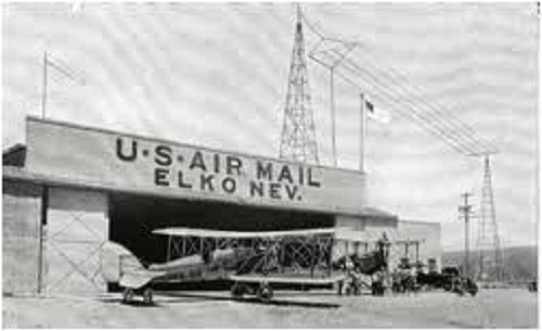
| 11 | Salt Lake City International Airport (KSLC) | Elko Regional Airport (KEKO) | TORAM11 | DC3 | 174 nm |
| 12 | Elko Regional Airport (KEKO) | Reno Tahoe International Airport (KRNO) | TORAM12 | DC3 | 199 nm |
| 13 | Reno Tahoe International Airport (KRNO) | San Francisco International Airport (KSFO) | TORAM13 | DC3 | 167 nm |
| Total Distance Of Tour: 2303 nm | |||||
| START: KFRG | Leg: 1 To: N96 | Leg: 2 To: KBKL | Leg: 3 To: 0G6 | Leg: 4 To: KPWK | Leg: 5 To: KIOW | Leg: 6 To: KOMA | Leg: 7 To: KLBF | Leg: 8 To: KCYS | Leg: 9 To: KRKS | Leg: 10 To: KSLC | Leg: 11 To: KEKO | Leg: 12 To: KRNO | Leg: 13 To: KSFO | Complete | |
|---|---|---|---|---|---|---|---|---|---|---|---|---|---|---|---|
| 1 | Pat Leclerc - MEC0157 |  | | | | | | | | | | | | |  |
| 2 | Tom Taylor - MEC0031 | | | | | | | | | | | | | | |
| 3 | Dave Anderson - MEC0025 | | | | | | | | | | | | | | |
| 4 | William Podolak - MEC0011 | | | | | | | | | | | | | | |
| 5 | Gary Barns - MEC0032 | | | | | | | | | | | | | | |
| 6 | Jeff Hoffman - MEC0007 | | | | | | | | | | | | | | |
| 7 | Jerry Hayman - Retired. - MEC0001 | | | | | | | | | | | | | | |
| 8 | Jon Richardson - MEC0013 | | | | | | | | | | | | | | |
| 9 | Nick Koos - MEC0045 | | | | | | | | | | | | | | |
| 10 | RAOUF RIZK - MEC0318 | | | | | | | | | | | | | | |
| 11 | Jim SIMS - MEC0235 | | | | | | | | | | | | | | |
| 12 | Gary Brooks - MEC0542 | | | | | | | | | | | | | | |
Click * To View PIREP

There have been 0 user(s), and 0 guest(s) online in the past 20 minutes.
Copyright © 2012 - 2026 - Mirage Executive Charters (MEC). All rights reserved.
For flight simulation purposes only. MEC is a fictional virtual airline with no association
with any real world airline, charter, or fractional.
All images are the explicit property of their respective owners.
Tour Module by Simpilotgroup | Charter Ops by CrazyCreatives
Site Design by PHP-Mods | Powered by phpVMS